
CL31
Lidar ceilometer for cloud base height and vertical visibility
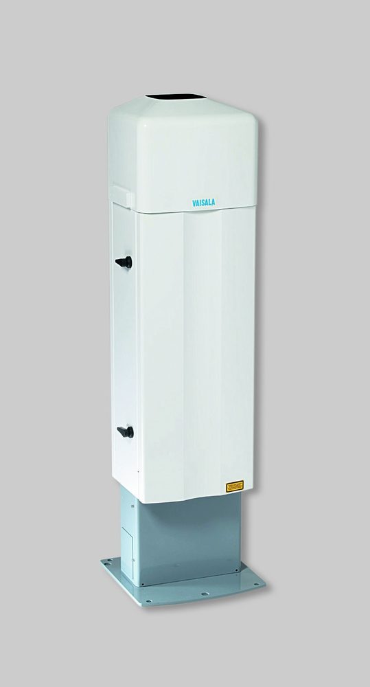
A compact ceilometer with pulsed diode laser lidar and second-generation single-lens optics, measuring from ground level up to 7.6 km and detecting 3 cloud layers simultaneously. A reference in aviation meteorology: it reports cloud base height and vertical visibility fully automatically, with extensive self-diagnostics.
Download datasheet (PDF)Technical specifications
- Measurement range
- 0–7,6 km (0–25.000 ft)
- Cloud layers reported
- 3 simultáneas
- Reporting resolution
- 5 m o 10 m (unidades seleccionables)
- Distance accuracy (hard target)
- ±5 m
- Operating temperature
- −50 °C a +60 °C
- Housing rating
- IP65 (unidad de medición); IPX6 con escudo de radiación
- Outputs
- RS-232; RS-485 multidrop; módem DXL421; opción LAN (Ethernet)
Key features
- 2nd-generation single-lens optics with excellent performance at low altitudes too
- Fast measurement that detects thin cloud layers below a solid cloud base
- Full backscatter profile for visualization and atmospheric analysis
- Vertical or tilted (12°) beam with automatic tilt-angle correction
- Radiation shield with automatic window blower and heater for rain, snow, and frost
- Modular design with extensive self-diagnostics and fault analysis
Typical applications
- Airports and civil aviation: METAR, ATIS, and operational minima
- Synoptic and climatological weather networks
- Military airfields and helipads
- Unattended automatic weather stations
- Boundary layer and air quality analysis (with BL-View software)

Need a quote for the CL31?
Check availability, pricing, and technical support. An AKRIBIS ecosystem specialist will respond within 24 business hours.